Intro Lesson: Staten Island, the “forgotten borough,” is geographically much closer to NJ than the rest of NYC. But we didn’t forget! And it’s not too far for our intrepid crew–this trip completes our sweep!
Word of the Day: borough
Old English: burg = town, walled fortress
The boroughs function as fortresses around New York Harbor.
Staten Island: We got an early start for the last NYC trip of the season, and it’s a good thing we did–turned out to be our longest trip! Thankfully, the paucity of hills kept us rolling and the ferry ride provided ample respite there and back.
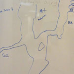
Jade, Zemika and Sabian helped label our map of the boroughs and tuned up their bikes before we headed south along the East River greenway. One milestone was mastery of the gears heading up that hill between the dog runs–Zemika and Jade cranked it out like pros. Sabian casually waited for us up top where he found a sprouting sumac.
The East River path is interrupted by the United Nations, requiring a diversion on to 2nd Avenue. Despite the “sharrows” marking the territory, it can still be a tricky stretch what with all the delivery trucks and construction in the way, but the crew handled it like champs. Nevertheless, it was refreshing to join the path again at 34th Street and we took our first healthy snack break in view of the Newtown Creek outlet across the East River.
Analogous to our transit under the High, Hamilton and Washington bridges last week, we passed under the Williamsburg, Manhattan and Brooklyn bridges this time and saw the construction of the mussel beds just north of the South Street Seaport.
We were surprised by the security dog assigned to sniff out bombs (?) on each bike, but the dog was friendly enough. While waiting in the designated area Cappy noted that the “MARSEC SECURITY” sign was redundant. Since “MARSEC” means “Maritime Security,” the sign is saying “Maritime Security Security.”
We boarded the ferry John F. Kennedy and enjoyed some great views of the harbor, including Governor’s Island, the statue of liberty and the Verrazano Bridge. As we neared the St. George terminal we had a great view of the skylines of Jersey City, Manhattan and Brooklyn from west to east.
Our destination on SI was Snug Harbor, which started as a community for aged mariners but has since become a culture center with lots to see. We headed deep into the estate to find the (not-so) Secret Garden–a hedge maze with a garden in the middle. We fueled up on pineapple slices before heading back the way we came and getting re-sniffed by the bicycle security dog. Although we were purportedly at Maritime Security Security level 1, we were surprised to see a Coast Guard boat with a big gun escorting us on the port side. And a matching vessel starboard. Wonder what that was all about.
For the return trip we continued around the tip of Manhattan, heading north along the west side through Battery Park. We passed our old friends the John J. Harvey fireboat and the Intrepid, and stopped under the West Side Highway to put Zemika’s pedal back on. Time for some new bikes for next season! A gentle cruise on the Riverside Esplanade above the “Freedom Tunnel,” across Central Park, and we made it back just as the Center was closing up. A monumental ride to close the season!
This trip was on August 21, 2012
Programming time: 7.5 hours
Ride time: 6.25 hours
Distance: 23.5 miles(!)
Participants:
| Sabian Gago | Jade Singleton | Zemika White |
Leaders: Cappy Collins, Onyx Salvador
2012 Staten Island
Highland Map


No Comments