Intro Lesson: Inwood is the northernmost neighborhood in Manhattan (almost–read ahead to learn more…) and one of the most interesting from geographic, ecological and historical perspectives. The hills of Inwood park contain the oldest growth remaining on the island and the shore contains Manhattan’s last tidal marsh. Inwood is also the location of Peter Minuet’s reputed purchase of the Island from the Lenape Indians, now marked by a metal medallion where an ancient tulip tree used to stand.
Word of the Day: marble
Inwood: Wow! What a ride! Jhevaughn led the lesson on Inwood and marble. Why marble? Well, Inwood is technically not the northernmost point of Manhattan because the Harlem River was rerouted south of Marble Hill to make ship navigation easier. The loop of river that used to flow around the north of Marble Hill was filled in, making it geographically contiguous with the Bronx, even though it’s still politically part of Manhattan!
First-timer Deandre joined us as we set off to the north, and he pointed out the church he attends–a remarkable 100-year-old structure in Harlem that was originally the Regent Theater.
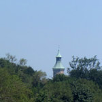
We passed more familiar sites along St. Nicholas: Harriet Tubman’s statue, food carts, St. Nick’s park and City College. We cruised through a police checkpoint for the cars (wonder what they were checking), and veered left at the watermelon guy at St. Nick’s Place. Jasmine had some technical difficulty when one of her pedals fell off, but it gave us a chance to admire the High Bridge water tower before descending down along the Harlem River Driveway.
Cappy took a wrong turn that took us all the way down to the Rangel housing by the river, but at least it gave us a nice view of the H.W. Wilson lighthouse that we saw on the Bronx High Bridge trip. Back up a ways we found the crossing to the narrow cement chute leading over the traffic and we descended to the amazing greenway along the Harlem River for our first break. Pineapple and grapes all around.
Ahead lay the High Bridge itself, the Hamilton Bridge (the eastern extension of the G.W. Bridge), and the Washington Bridge (confusingly, not the G.W. extension): amazing views from underneath all of them. A lot of work is being done along the Manhattan cliffs to restore some of the park amenities.
On a future trip we should stop at the parkland and wilderness areas around the Peter Jay Sharp Boathouse–looks like some great shoreline restoration and education facilities are in the works.
Hugging the eastern shore, we merged onto 10th Avenue, which, yes indeed, is an extension of the same 10th Avenue that’s on the west side in midtown! The discontinuity of 10th Avenue (which is called Amsterdam Ave most of the way) reminds us of the aliases for Avenue A on one of our earlier trips.
Deandre and Calvin were keen on stepping across to the Bronx, so the rest of the crew waited patiently as Cappy led them across the Broadway Bridge into Marble Hill. Again, technically the Bronx doesn’t start until 230th Street, but we’ll call it close enough for their Bronx Badge.
The two crews re-converged and headed into Inwood Park. While searching for a restroom (the nature center was locked!) we saw a snowy egret in the tidal marsh, the Henry Hudson Bridge extending to Spuyten Duyvil, the exposed marble rock of Marble Hill, a flock of Canada Geese roaming the grass, the hills supposedly hiding “Indian Caves,” and plenty of baseball teams scattered across the fields. After freshening up Cappy roamed the edge of the park at the foot of the hilly ridge until he found the plaque representing the old tulip tree. The rest of the crew stormed across the field–a wheeled batallion–to see the Shorakkopoch Rock, site of the (apocryphal?) purchase of Manhattan.
Time to head back. We found Dyckman Avenue and the entrance to the west side greenway. Of the many sites to see, Inspiration Point was especially notable for it’s surprising location only accessible from the bike path and great views of the Palisades across the Hudson. Other highlights along the path include the “pumpkin house,” the repaired retaining wall that collapsed in 2005, and the George Washington Bridge. Our last rest stop was underneath the G.W.; cherries never tasted so good. Sabian and Deandre tried to throw rocks across the mighty Hudson.
We were exhausted by the time we got back to the club, but it was worth it!
This trip was on August 16, 2012
Programming time: 6.25 hours
Ride time: 5 hours
Distance: 19.1 miles (Sabian and Jasmine), 19.8 miles (Calvin and Deandre)
Participants:
Sabian Gago: NA
Calvin Debrecourt |
Deandre Decarmo |
Jasmine Romero |
Leaders: Cappy Collins, Jhevaughn Langley, Kara Metcalf, Onyx Salvador
2012 Inwood


We got such a better view on the highbridge
awww just got back from camp yesturday I miss cyclopedia